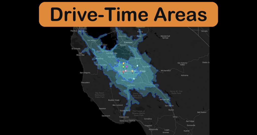
How Far Is 15 Minutes? Introducing Drive-Time Areas
Create an isochrone map in ZeeMaps: highlight drive-time areas around one address, every pin on your map, or a whole spreadsheet of locations.
Create an isochrone map in ZeeMaps: highlight drive-time areas around one address, every pin on your map, or a whole spreadsheet of locations.
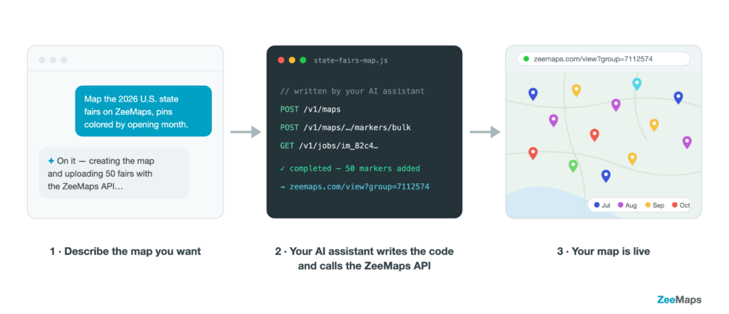
The new ZeeMaps REST API lets your software — or your AI assistant — create maps, add and update markers, search locations, and render map images automatically.
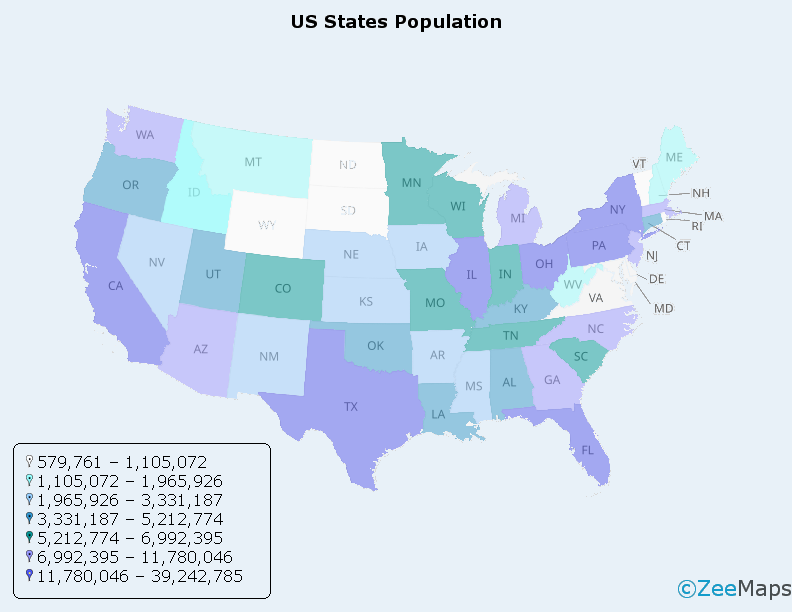
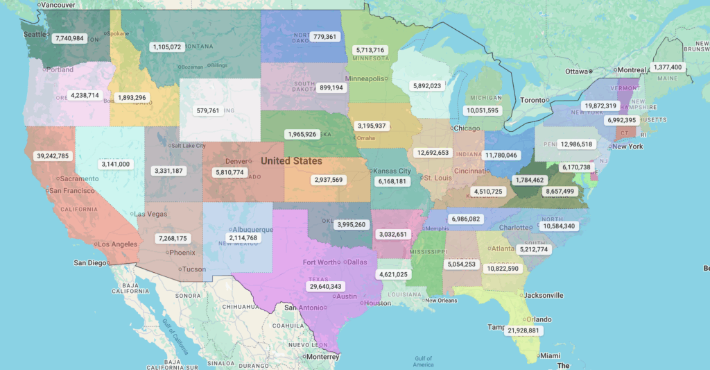
A spreadsheet full of numbers rarely tells a story. A color map by data values tells it instantly. With ZeeMaps’
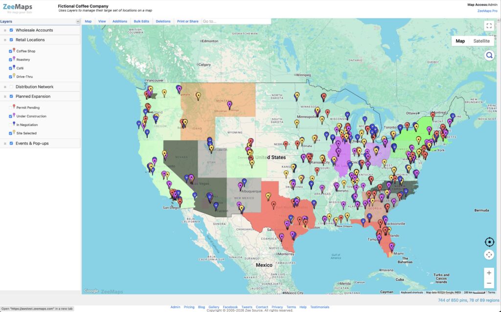
Organize your map data in two dimensions We introduce Map Layers as a foundational new feature for organizing your map data.
Managing annotations in ZeeMaps just received a major upgrade. We’ve introduced a modern annotation editor that makes it easier than ever
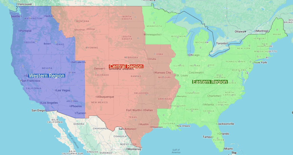
ZeeMaps supports highlighting regions on maps, making it easy to visualize sales territories, service areas, or marketing reach. Highlighted areas are