Introducing Map Layers
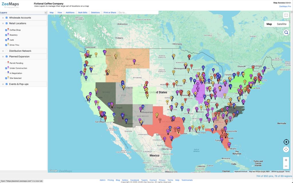
Organize your map data in two dimensions We introduce Map Layers as a foundational new feature for organizing your map data. […]
Organize your map data in two dimensions We introduce Map Layers as a foundational new feature for organizing your map data. […]
In the following video, we show the steps to create a 4 feet by 4 feet customized poster map with
Sometimes you may have a map with markers on the same location, e.g., different offices in the same building. When
Happy New Year! ZeeMaps now has significantly improved map display in smartphones and tablets. Point your mobile browser to your
ZeeMaps now supports numbered markers in print images. When you get a print image, using the Print or Share →
ZeeMaps supports marker “clustering” for improved performance. Clustering groups nearby markers into “clusters” and shows them as small blue circles,