Online Map Secure Sharing with ZeeMaps
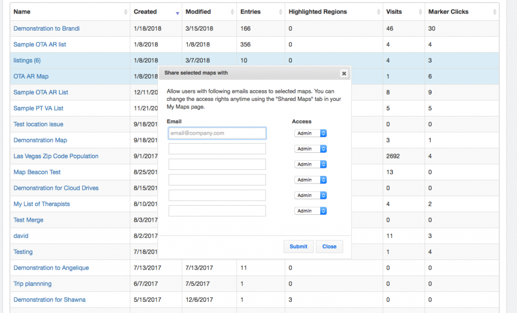
ZeeMaps online map sharing options range from secure personalized sharing to publishing a map on a website. This article describes […]
ZeeMaps online map sharing options range from secure personalized sharing to publishing a map on a website. This article describes […]
You can get US Map images from ZeeMaps in different sizes and resolutions, e.g., to print out a wall-poster, or
You can easily get a customized world map image with ZeeMaps. First, create a map using the “Create a Free
If you have a map published in a secure (https) site, please read on. Recently Firefox and Chrome have stopped
We have revised our subscription and pay-per-use pricing to provide more flexible options. Frequent users of ZeeMaps will benefit from
Use the Print or Share > Share Link/URL menu item on your map, to get a small URL that you can