Google Maps often display local business listings. When you are searching for local businesses, this can be a useful feature. At other times, however, the business pointers can clutter the map, or worst show competitor’s business on your map!
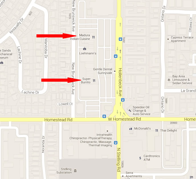
For example, in the following map of a block around our offices, several businesses are listed, such as one Indian and one Mexican restaurant. If you are a paid subscriber, ZeeMaps will allow you to remove these business listings from your map.

Use the Map -> Settings menu to get the Map Settings page, and then select the Map Display tab to change the map display settings.

Within that, check the box that says “Remove local business listings from map”:

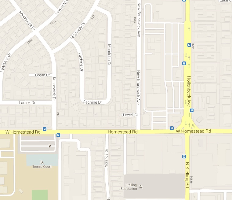
Once you have set this checkbox, now if you go back to the map, the local businesses will no longer show:

The business listings will not show on your map as long as you have signed-up for one of our paid plans.
Author: zeemaps
Create a Large Poster Map with ZeeMaps
In the following video, we show the steps to create a 4 feet by 4 feet customized poster map with ZeeMaps, suitable for printing and hanging on walls, etc. As with any map images, you need to experiment a bit with the map area and size to get the image that you want.
For world maps, due to the projection and aspect ratio used for mapping, it is best to go with a square image.
Always try a bigger size than what you need to get more information on the map.
Maps published in secure (HTTPS) sites not showing in Firefox and Chrome
If you have a map published in a secure (https) site, please read on.
Recently Firefox and Chrome have stopped showing mixed mode (secure and non-secure) content through IFRAMEs.
In order for your secure published map to work in Firefox and Chrome, please get a new publish HTML code from ZeeMaps, or change the SRC URL of the IFRAME to HTTPS from HTTP.
Let us know if we can provide any additional assistance.
Re-Positioning or Relocating Markers
Sometimes when you add a marker on a map. It is not positioned exactly where you’d like it to be positioned. There could be many reasons for this: e.g., the address information was not geo coded correctly. Or, you do not want to position the marker on the exact address. or there are multiple markers on a location and you’d like to tease them apart.
ZeeMaps allows you to drag-and-drop markers to reposition them.
To enable drag-and-drop, click on the marker. In the resulting information bubble, click on the first icon to the right bottom of the information bubble.

This should allow you to drag-and-drop the marker to its new location.
Zip Code – Highlight and Color US Counties
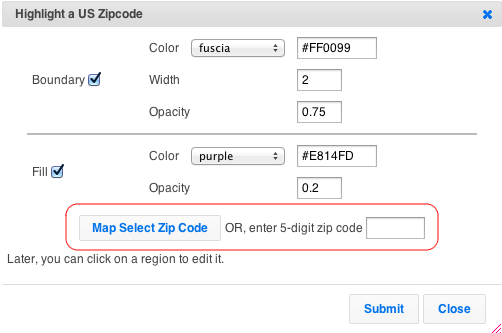
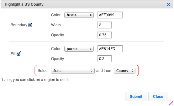
Use the Additions -> Highlight US County, or Additions -> Highlight US Zip Code to color any zip or county in the US.
For Zip Codes, you can either specify a five digit zip. Or, click on the map to get the value for locations.
For Counties, select a state and county.
As all highlighted regions in ZeeMaps, counties and zip codes regions have a boundary and fill, which can be customized for color, etc..
Once you’ve created a region, you can make changes to it by accessing your map as Admin. Then, click on a region to modify it. In the case of countries, states, counties, cities, or zip, you can change the boundary and fill coloring at any time. With hand-drawn regions, you can also change the shape. For radius regions, you can additionally change the size and location.
For example, below is a map of Los Angeles with the famous 90210 (Beverly Hills) area highlighted.
The highlighted regions work both on the interactive maps and the static images, as shown in the image below.
Find your Zip Code data
Under the OPEN Government Data Act, which is Title II of the Foundations for Evidence-Based Policymaking Act, government data is required to be made available in open, machine-readable formats, while continuing to ensure privacy and security.
You can search Data.gov from its catalog of government data from across the Federal Government. Once in the catalog, to find datasets you can:
- Enter keywords in the search box.
- Browse on the left side through types, tags, formats, groups, organization types, organizations, and categories. Clicking on multiple items narrows your search. You can click on the “x” to the side of any single item to remove it from the search, or “clear all” to remove all selected items in a category.
- Search by geospatial area by drawing a boundary box on the map at the left side and clicking “Apply” to find all datasets that are tagged for that geographic area.
Click here for more information on locating zip code data


