ZeeMaps allows you to lock the zoom levels on your interactive maps.
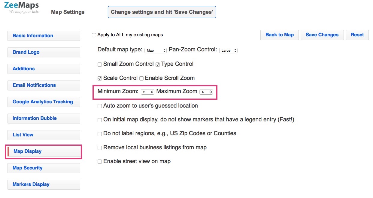
Use the Map -> Settings menu item to get to the settings page, and then click on the tab for “Map Display”.
Select the minimum and maximum zoom levels, and hit Save Changes.

Go back to the map, and you’ll notice that the map zoom controls do not allow the map to be zoomed-out below the minimum zoom level, or zoomed-in more than the maximum zoom level.
Author: zeemaps
Map Pins with Labels
You can label your map pins, using up to three characters from a field value on your map. For example, you can label your map pins with store numbers, for a store locator map.
First, create a map with your location list. Make sure you have one of the data fields that contains the labels that you want to put on your pins. The field value may be as long as you want, but only the first three characters or less will be used for the labels.
Set the Labels
To set the labels, go to the Map Settings page (menu item Map -> Settings) and then click on the Markers Display tab. In the drop-down for the “Label markers using field” select the appropriate field and hit “Save Changes”.

Your pins should now be labelled using the field value. Note that the labels will only show with larger pins and not if you have your markers set as small pins.
Postcode Finder for Australia, Interactive
We’ve added the ability to highlight and find postcodes in Australia. You can highlight postcodes, or find postcodes that are within a specific area on the map.
“Postcodes are used in Australia to sort and send mail to the correct address. All postcodes in Australia have four digits and are placed at the end of the address. Australian postcodes are managed by Australia Post.” from the Wikipedia article on postcodes in Australia.
Highlight Postcodes in Australia
To highlight one more Postcodes in Australia, use the Additions -> Highlight Regions -> Zip (Post) Codes -> Australia Postcodes menu item on your map.

In the resulting dialog, enter one or more four digit postcodes separated by commas or spaces. Specify the color for the highlighted area and the boundary and hit Submit.

For example, here’s a map with postcodes 0872 and 6440 highlighted.
Postcode Finder for Australia
To lookup postcodes that are in a specific area in Australia, use the Additions -> Highlight Regions to define your region. Then, use the menu View -> Lookup Zip (Post) codes menu item and click on your highlighted region. That should show you a list of all the postcodes that fall in the given region.

Driving Directions using Search on a Mobile Map
ZeeMaps allows you to search your pinned locations on mobile phones. This can be specifically handy if you are looking to get driving directions to your pins that satisfy a certain criteria, e.g., locate all the Gold customers in your vicinity and get driving directions to them.
First create the map on ZeeMaps, then add pins on the map. ZeeMaps provides several easy ways of adding pins: one at a time, uploading through spreadsheets, copy-and-pasting from a table, and so forth. You can add as many pins as you like on a given map. For example, if you are sales person, you might want to create a map with all your customers, potential customers, leads, etc., on a single map. To distinguish the customers from potential and leads, you can also use different colored pins for each category.
Search Menu
To perform a search, click on the menu icon on your map to activate the menu, and then click on the Search item.

Search Dialog
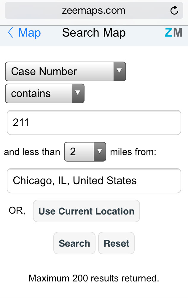
This should bring up a search page, where you can search based on any of your marker fields, e.g., name, description, and combine it with a distance search. For example, you can search for all locations with case number (custom field ) 211 within 2 miles from Chicago, IL.

Driving Directions
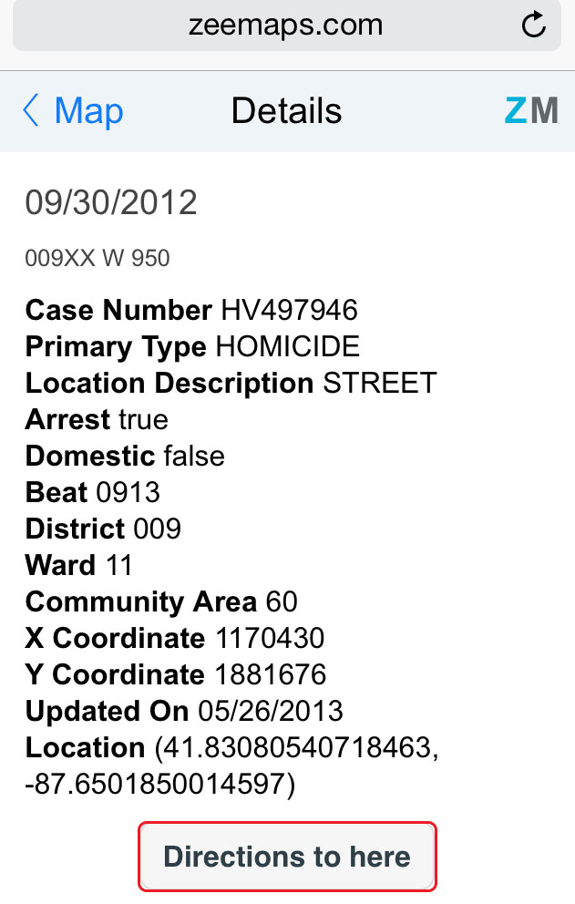
Once the search is performed, the markers on the map and list will be limited to the ones that matched the search. Go to the map to see the locations, or click on the menu again to get to the list. Click on any entry on the map or the list to get to the entry, and then click on the Directions button to get directions to the place. Depending on your mobile phone, you will either be directed to Google Maps or Apple Maps for directions.

Zip Code Lookup on a Map with ZeeMaps
ZIP codes are a system of postal codes used by the United States Postal Service. ZeeMaps supports Zip Code Lookup, using the View -> Zip Code Lookup menu item on your map.
Zip Code Lookup for Texas
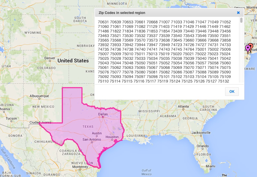
For example, suppose you want to lookup all Zip codes for the state of Texas. Highlight the state of Texas, using the Additions -> Highlight Regions -> States on your map.
Then, once the state of Texas has been highlighted, select the menu item View -> Zip Code Lookup, and click an the highlighted Texas region. You’ll get a list of all Zip Codes in Texas.

The same feature can be used to lookup Zip Codes of a particular city, county, or an arbitrary building. You can click on a building to get the Zip Code of the building instead of the area. You are not limited to using pre-defined regions for doing a zip code lookup. Since ZeeMaps allows you to define arbitrary areas like circles, rectangles, polygons and hand-drawn, you can lookup zip codes for any region on the map.
Unlike the US Postal Service’s Zip Code Lookup service, with ZeeMaps you can easily lookup zip codes for an entire region, instead of having to do it one zip code at a time.
When you click on an highlighted region, the lookup is done for the entire region. If you want to find the zip code for a point within an highlighted region, first click outside the region and then move the zip code locator to the point inside the highlighted region.