ZeeMaps allows you to lock the zoom levels on your interactive maps.
Use the Map -> Settings menu item to get to the settings page, and then click on the tab for “Map Display”.
Select the minimum and maximum zoom levels, and hit Save Changes.
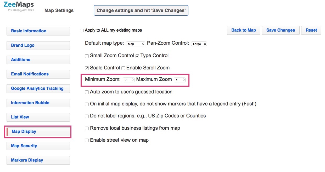
Go back to the map, and you’ll notice that the map zoom controls do not allow the map to be zoomed-out below the minimum zoom level, or zoomed-in more than the maximum zoom level.
Category: display
Map Pins with Labels
You can label your map pins, using up to three characters from a field value on your map. For example, you can label your map pins with store numbers, for a store locator map.
First, create a map with your location list. Make sure you have one of the data fields that contains the labels that you want to put on your pins. The field value may be as long as you want, but only the first three characters or less will be used for the labels.
Set the Labels
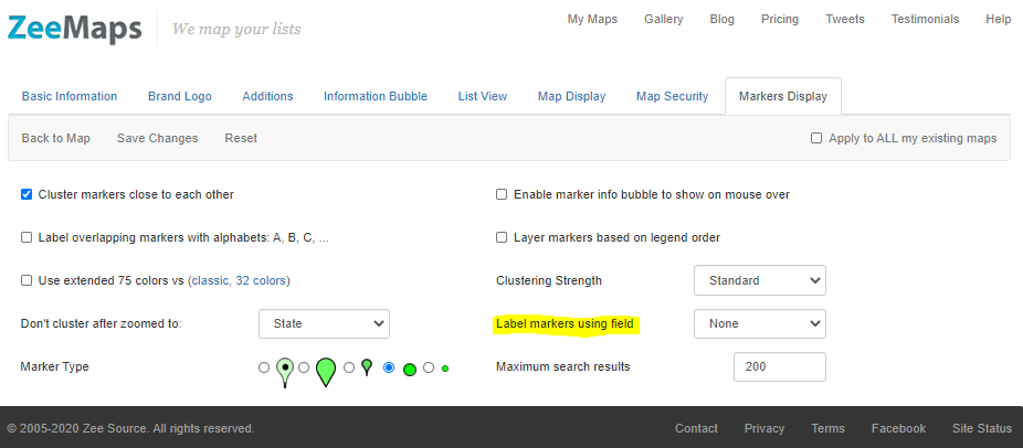
To set the labels, go to the Map Settings page (menu item Map -> Settings) and then click on the Markers Display tab. In the drop-down for the “Label markers using field” select the appropriate field and hit “Save Changes”.
Your pins should now be labelled using the field value. Note that the labels will only show with larger pins and not if you have your markers set as small pins.
Postcode Finder for Australia, Interactive
We’ve added the ability to highlight and find postcodes in Australia. You can highlight postcodes, or find postcodes that are within a specific area on the map.
“Postcodes are used in Australia to sort and send mail to the correct address. All postcodes in Australia have four digits and are placed at the end of the address. Australian postcodes are managed by Australia Post.” from the Wikipedia article on postcodes in Australia.
Highlight Postcodes in Australia
To highlight one more Postcodes in Australia, use the Additions -> Highlight Regions -> Zip (Post) Codes -> Australia Postcodes menu item on your map.

In the resulting dialog, enter one or more four digit postcodes separated by commas or spaces. Specify the color for the highlighted area and the boundary and hit Submit.

For example, here’s a map with postcodes 0872 and 6440 highlighted.
Postcode Finder for Australia
To lookup postcodes that are in a specific area in Australia, use the Additions -> Highlight Regions to define your region. Then, use the menu View -> Lookup Zip (Post) codes menu item and click on your highlighted region. That should show you a list of all the postcodes that fall in the given region.

Enable street view on your maps
Paid subscribers can enable street view on their maps.
Use the Map -> Settings menu to get to the Map Settings page.

Once on the settings page, go to the tab for Map Display and then check the box that says “Enable street view on map” and hit submit.

You need to be a paid subscriber for the street view to be enabled on your maps.
For example, here’s a sample map with Street View enabled:
Adding Concentric Circles on a Radius Map
ZeeMaps makes it easy to add concentric circles on a radius map.
To add your concentric circles, create your radius map, and click on the menu item Highlight Regions -> Circles.

This should give you a dialog to specify your circles center, and enter multiple radiuses (separated by commas or spaces) for the circle in miles. Customize the fill and boundary color specifications and Submit. For example, in the following dialog, we have specified a set of five concentric circles centered around Paris.

To specify the center for the circles, you can either select the location by clicking on the map or enter the geographical coordinates as latitude and longitude (decimal format).
We did this on our demonstration map, Visiting Austin, by creating concentric circles around the hotel that someone might be staying in. The interactive map resulting from this, is shown below:
Once you have added concentric circles, you can modify them by clicking on any of the circle. You can change the radius of the clicked circle by dragging one of the empty dots on the circumference. To modify the center of all the circles, drag the center of the clicked circle. Finally, you can change the fill or boundary of all the circles by changing them on the clicked circle.
The circles will show on print images as well. For example, here’s a small PNG image from the map that we created above.
