Radius mapping is an essential tool for businesses, marketers, and researchers who need to plan and visualize distances. Whether you want to identify potential customers, plan delivery routes, or pinpoint locations within a certain distance, drawing accurate radius maps is crucial.
Learn what is a radius map, and how you can use a radius map creator like our own to enhance your data visualization tools and make better business decisions.
What is a Radius Map?
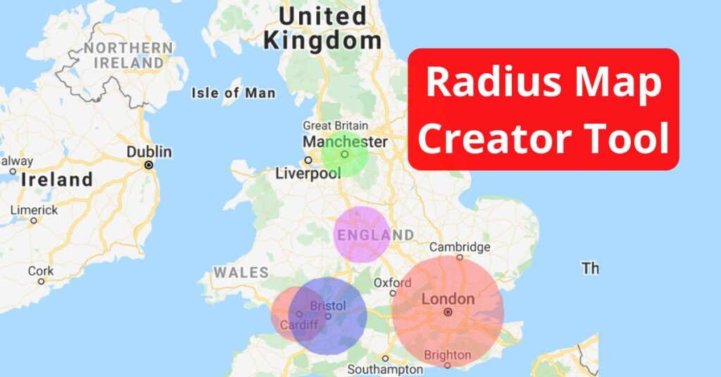
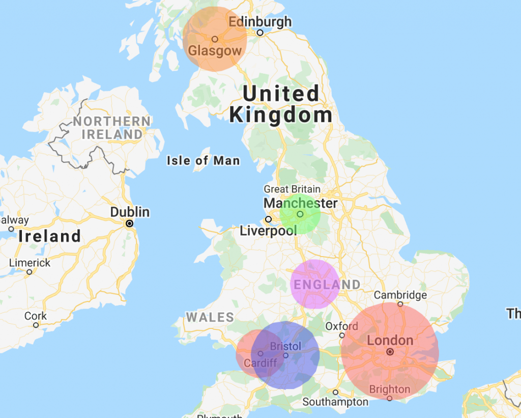
A radius map is a type of map that shows a visual representation of a circular area on a map. In essence, it illustrates the distance from a central point to the outermost circumference of the circle. The central point is typically a specific location or address of interest, and the radius represents the distance from that point.
They are typically used for purposes such as marketing, logistics planning, market analysis, and real estate development. For example, a retailer might use one to figure out where the next location of their store should go, based on how far customers are likely to travel to get to one.
Radius Map Examples
1. Marketing and Sales
By visualizing the area covered by the radius map, businesses can tailor their advertising strategies and campaigns to reach customers in that target market.
2. Logistics Planning
Radius maps help optimize delivery routes by determining the most efficient distribution centers for businesses to use, based on the proximity to customer clusters.
3. Market Analysis
Researchers can analyze market potential by studying population density and competitor locations within specific areas defined by radius maps. Companies can use that information to target different consumer segments more effectively.
4. Real Estate Development
For property developers and real estate agents, they can assist in figuring out the proximity of amenities and services to potential properties, influencing investment decisions.
How to Create Your Own Radius Map
Ready to use radius maps for your own business? ZeeMaps offers online tools to help you create accurate and visually appealing maps. Our tools are easy to use, have great customization options, and you can save or export the maps for future use once you’re done.
- Process Your Data: Ensure that your dataset is clean and well-structured. This involves removing duplicate or irrelevant data and handling missing values.
- Use Multiple Maps: If you have multiple locations or circumference requirements, consider creating separate radius maps for each scenario. This can help your viewers avoid confusion.
- Customize Visualization: Experiment with colors, symbols, and sizes to represent the radius in an appealing and informative way.
- Choose a Radius: You can customize your radius to be a small distance, like five miles, or a bigger circumference. Determine what size radius makes sense for your data and goals.
- Use ZeeMaps to Create Your Own: Check out our tutorial for a step-by-step guide to create your own.
Inspired by this map?
Create your own interactive map with ZeeMaps in minutes.