You can highlight regions on your map in ZeeMaps to get a PostCode Area map for Great Britain.
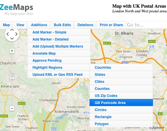
To highlight post code areas, use the Additions -> Highlight Regions -> GB Postal Areas on your map.
Then, select one or more postal areas, color their boundary and fill and hit Submit. That should highlight the postal areas on your map.

For example, here’s a map with the London North and London West highlighted:
Not currently, but we are looking into adding that capability. Will keep you posted.
*instead of the whole of SW
Hi Marc, Turns out we do not have a way of highlighting just the postal code, only the whole post code area.
Hi, is there any way to highlight areas by the full outward code, ie. SW15, SW16 and so on instead of the whole of SW16?
Thanks