
A storm does not check your calendar. Whether your map shows field crews, delivery stops, store locations, or this weekend’s event venues, weather is the one variable that can upend the plan on an hour’s notice. A live weather hazards map puts that variable on the same screen as everything else you manage.
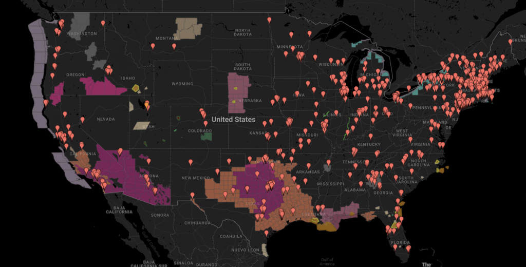
With ZeeMaps’ new Weather Hazards overlay, you can see every active weather watch, warning, and advisory from the U.S. National Weather Service drawn live on your own map — tornado and severe-thunderstorm warnings, flood watches, winter storms, high winds, fire weather, extreme heat, and more, right over your pins and regions.
Turning it on takes one click, and clicking any shaded area tells you exactly what is happening there.
What Is the Weather Hazards Map Overlay?
The overlay is the National Weather Service’s consolidated hazards map — the same live picture of active watches, warnings, and advisories you would see on weather.gov, in the same official colors, refreshed about every five minutes.
A quick refresher on the three levels: a watch means conditions are favorable for a hazard, a warning means it is happening or imminent, and an advisory covers less severe conditions that still deserve caution.
On your map, hazard areas are drawn semi-transparent over the base map, so the streets stay readable and your pins stay on top. The difference from checking a weather site is simple but powerful: the hazards appear in the same view as your locations, so “is anything of ours affected?” is answered at a glance.
Turn the Weather Hazards Map On in Seconds
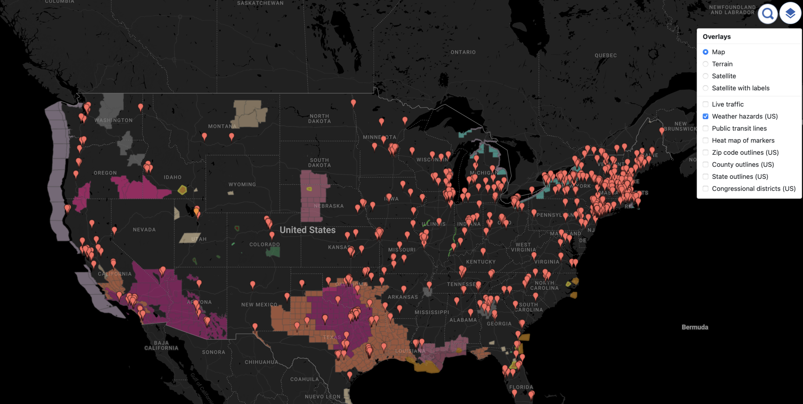
- Open your map and click the Overlays button in the top-right corner of the map.
- Check Weather hazards (US).
That is all. Every active hazard area appears immediately, and the weather hazards map keeps itself current while your map is open. Your choice is remembered in your browser, so the overlay comes back the next time you open the map.
Click Any Hazard for the Full Story
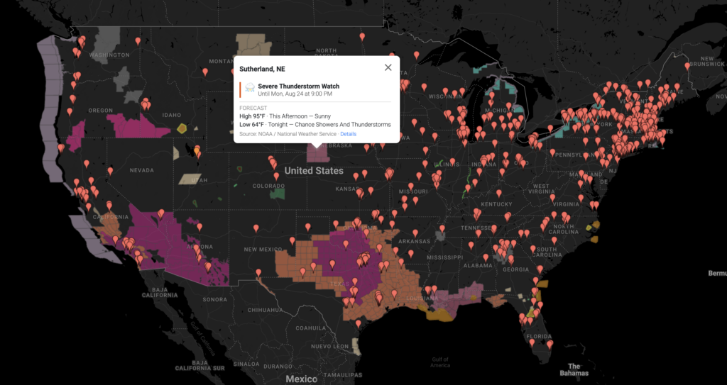
A storm warning map is only as useful as the detail behind it. Colors tell you something is happening; a click tells you what. Click anywhere inside a shaded area and a popup shows:
- The nearest city and state, so you know exactly where you clicked.
- Every alert active at that point, sorted by severity, each with an icon for its hazard type.
- The forecast high and low for that spot.
- A Details link to the full National Weather Service alert text — timing, affected counties, and recommended actions.
Make It the Default for Everyone
Sharing the map with a team, or embedding it in your website? You can make the overlay start on for every visitor: open your map’s Settings, choose Display, and check Overlay live weather hazards (US).
Each viewer can still toggle the weather alert map off from the Overlays panel — the setting simply chooses the starting state. And because the feature follows the map, everyone you share it with sees the hazards, on the published page and in embeds alike.
What Can You Do with a Weather Hazards Map?
- Field operations: see at a glance which crews, technicians, or job sites sit inside a severe-thunderstorm or tornado warning right now.
- Deliveries and logistics: spot the routes and stops a winter storm is about to bury before the trucks roll.
- Events: check this weekend’s outdoor venues against flood watches and high-wind warnings.
- Retail and facilities: know which stores are under a hurricane or extreme-heat warning — and who to call first.
- Community organizations: lay hazards over a member map to see who may need a check-in as a storm moves through.
- Insurance and claims: watch warned areas against your policyholder map as an event unfolds.
Related articles:
- Add Public Transit Overlay to Your Custom Map
- How Far Is 15 Minutes? Introducing Drive-Time Areas
- Introducing Map Layers
Good to Know
- The weather hazards map covers the United States. Outside the US, your map works exactly as before — the overlay simply has nothing to show.
- The data is live from the National Weather Service, refreshed about every five minutes, in the official NWS color coding.
- Weather Hazards is an Enterprise plan feature, like Live Traffic (see pricing). Viewers of your map get it automatically — the feature follows the map, not the viewer.
- It works on your existing maps — there is nothing to re-create or re-import.
Final Thoughts
Your map already shows where everything you care about is. Now it can show what the weather is about to do about it — a live weather alert map drawn from the source forecasters themselves rely on.
Open any of your maps, click Overlays, and check Weather hazards (US). The next storm will not be a surprise.